EMERGENCY NUMBERS
In the event of a life-threatening situation, call 112 immediately
Always inform the service staff! (Who else should open the barrier?)
In case of emergency you can reach the service staff 24 hours a day on +31(0)6 - 12 86 73 76 and at the service staff accommodation in the Adventure House.
You are responsible for initial care at first aid and you have all the materials with you to perform first aid procedures.
You can reach the police on 0900-8844
You can reach the fire brigade on 0900-0165
If you visit the doctor, dentist, police or other care provider, please let us know.
General practitioners
General practitioners for tourists are subdivided by last name of the patient. Check with the service staff the schedule of the GP on duty
Evenings, nights and weekends, call the GP post in the St. Jansdal hospital, Wethouder Jansenlaan 90, Harderwijk T +31(0)85 - 773 73 71. Always call first!
Hospital
St. Jansdal Harderwijk, Wethouder Jansenlaan 90, Harderwijk
T +31(0)34 - 146 39 11
Pharmacy
Benu Apotheek, Horsterweg 30, Zeewolde
T +31(0)36-522 14 44
Benu Apotheek Atlantis, Krachtenveld 1-5, Zeewolde
T +31(0)36-522 02 21
Dentist
Tandartspraktijk De Elementen, Telluur 8, Zeewolde
T +31(0)36 - 522 60 06
Dental Clinics Zeewolde, De Weerdt 3, Zeewolde
T +31(0)36 - 522 28 36
Tandartspraktijk Goudswaard, Raadhuisstraat 15-17, Zeewolde
T +31(0)36 - 522 20 70
Scoutinglandgoed Zeewolde tries to be as sustainable as possible. This means that we do not offer facilities such as those offered at a commercial holiday park or campsite. In this way, our Scouts learn that you can also have a great time (Adventure in Nature) with us in a simple way, with limited resources, and with less luxury. If there is a medical necessity (for example sleep apnea or keeping baby food cool) for electricity, we offer this to a very limited extent.
To ensure that the connections (6 Ampère) are realised on time, it is important that the following information is known to us at least 14 days before your arrival.
On the following fields (or parts thereof) it is possible to install electricity within a circle of 25 to a maximum of 50 metres. Please note that in order to prevent fire hazards and, more importantly, to prevent loss of power, we set requirements for the reel/extension cable that you will use.
The fields where limited power is possible are:
Heerenkoog 2 | Berlisi 1 | Adhingerdorp | Espelo | Tollebeek | De Knar | Hofstede | Zomp 1 | Bol | Togenaer | Wilde eend 3 & 4 |
Useful to think about in advance
- All requests are assessed by our technicians (volunteers) based on the total availability of electricity on the entire site. This may mean that we cannot (fully) realize all requests.
- Our volunteers will in all cases install and connect the electricity; if it concerns special requests, an hourly rate will be charged by our volunteers for support with the connection, in addition to the material and consumption costs.
- Requests must be known to us at least 14 days prior to the day of arrival.
- If you cancel the electricity request, the regular cancellation costs apply as stated on the website.
- Safety requirements: the cable/cord must have a minimum thickness of 1.5 mm2 and may not be longer than 50 meters. Connecting multiple cables/cords is not permitted.
- If available, we supply 240 volts with a maximum capacity of 6 amps.
- If you have not brought the correct reel/extension cable, we will refuse you an electricity connection.
When constructing our site, major activities by and for the members of Scouting Nederland were also taken into account. For example, every 2 years an activity is organized for all Dutch volunteers on our site (Scout-In), every 4 years the Nawaka (National water camp) for water scouting groups and every four years the National Jamboree for land and air scouts.
We also offer space for larger activities that suit our site and complement our mission, offering a place where children can play outside and discover the nature around them.
The large activity fields Kievit, Grutto, Scholekster, Graspieper, Kleine plevier and Knobbelzwaan have a semi-paved area for sanitary units, containers, heavy equipment, etc. In addition, all connections required for water, electricity and fiber optic cables are located underneath these fields. .
We have a maximum of 25 KVA on the entire site and it is possible to install environmentally friendly generators. These can be fully linked to our infrastructure. The following connections are available at various activity fields:
1 x 32 Ampere, 400V
3 x 16 Ampere, 240 V
Optical fiber
Sewer pit and drain
Greywater water connection
Water connection for drinking water
The availability of the above specification is dependent on other activities on site.
Connecting the desired facilities is done in close consultation with our technical people.
Visiting and postal address
Scoutinglandgoed Zeewolde
Nulderpad 5
3896LV Zeewolde
The Netherlands
Email addresses:
🕹
🕹
Telephone (while present)
📞 +31 (0)36 820 12 06
📞 +31 (0)612 86 73 76
KvK | 63500337
BTW | NL855262825B01
IBAN | NL82INGB0006883410
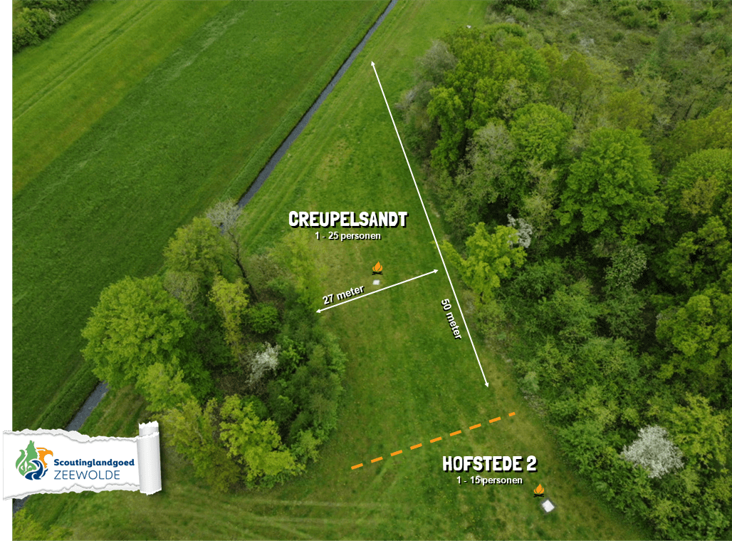
CREUPELSANDT
![]()
![]()
![]()
![]()
![]()
![]()
![]()
![]()
![]()
![]()
![]()
![]()
![]()
![]()
![]()
![]()
![]() max 25 personen
max 25 personen
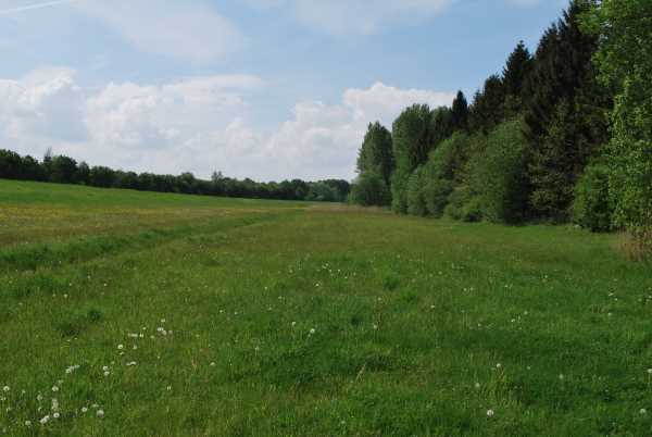
East of Creupelsandt near Urk is a sandbank with the striking name 'Hofste' or 'Hofstede'. The legend tells that 'the old Casteel Cruptorix, said van der Hoeve, now called the plate Kreupel, drowned under the waves of the Zuyder-Zee.'

HOFSTEDE 1-2
![]()
![]()
![]()
![]()
![]()
![]()
![]()
![]()
![]()
![]()
![]()
![]()
![]()
![]()
![]()
![]()
![]() max 15 personen
max 15 personen
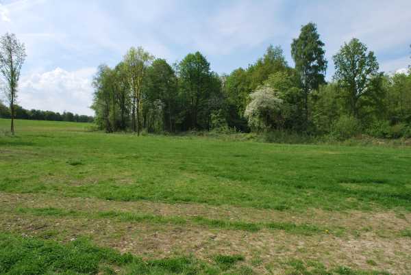
East of Creupelsandt near Urk is a sandbank with the striking name 'Hofste' or 'Hofstede'. The legend tells that 'the old Casteel Cruptorix, said van der Hoeve, now called the plate Kreupel, drowned under the waves of the Zuyder-Zee.'

KNAR 1-2
![]()
![]()
![]()
![]()
![]()
![]()
![]()
![]()
![]()
![]()
![]()
![]()
![]()
![]()
![]()
![]()
![]() max 30/10 personen
max 30/10 personen
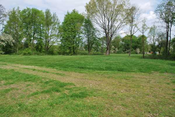
When the Zuiderzee still existed, the Knar was a household name. For fishermen this meant a place rich in fish; skippers of cargo ships knew: it is not safe to sail here, because it is extremely shallow. The Knar was already known before the Zuiderzee came into existence. At that time it served as a safe height in the swamp that covered Flevoland in the distant past. Found habitation remains testify to this. The current Knarbos is partly located on the former Knar sandbank.
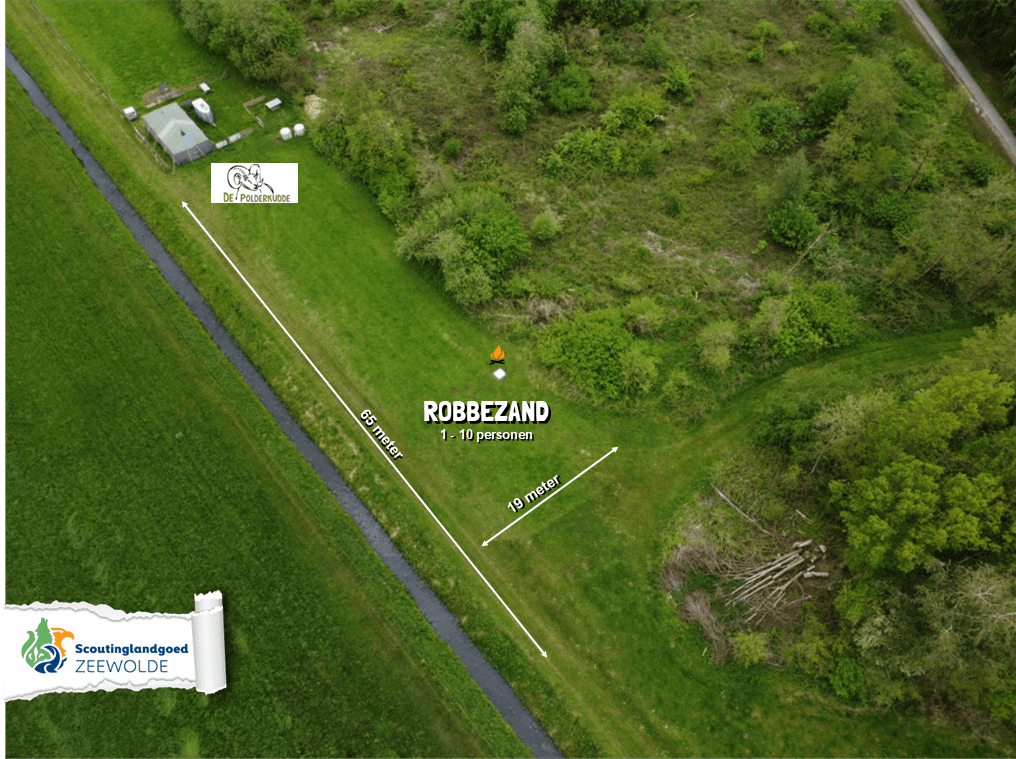
ROBBEZAND
![]()
![]()
![]()
![]()
![]()
![]()
![]()
![]()
![]()
![]()
![]()
![]()
![]()
![]()
![]()
![]() max 10 personen
max 10 personen

Near the old island of Wieringen in the Zuiderzee was the seal plate, from the period when seals and porpoises could still be found in the Wadden and Zuiderzee.
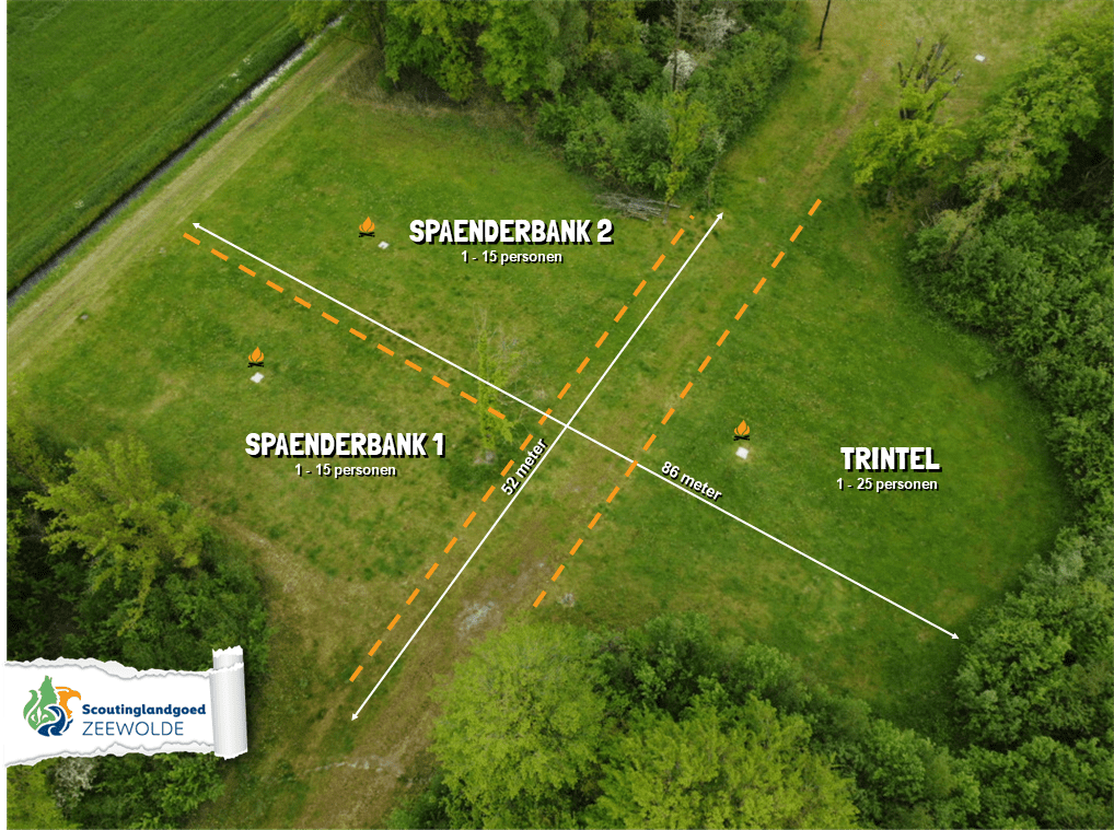
SPAENDERBANK 1-2
![]()
![]()
![]()
![]()
![]()
![]()
![]()
![]()
![]()
![]()
![]()
![]()
![]()
![]()
![]()
![]() max 15 personen
max 15 personen
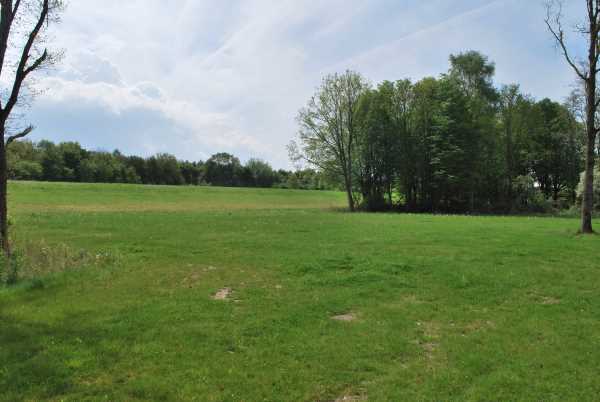
Spaenderbank was a sandbank in the former Zuiderzee.

TRINTEL
![]()
![]()
![]()
![]()
![]()
![]()
![]()
![]()
![]()
![]()
![]()
![]()
![]()
![]()
![]()
![]() max 25 personen
max 25 personen
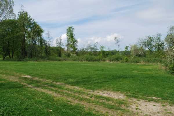
Trintel was a sandbank in the Zuiderzee between Enkhuizen and Lelystad. Natuurmonumenten now wants to create new nature in the area, with one of the sub-projects being called Trintelzand.
Zelhorst is not rented out as a camping field, but is generally available as a playing field. During the season the stretch tent is often also located here.
Zelhorst is a village that was planned near Harderhaven but was never built. There used to be a Saxon castle (Selhorst) near Harderwijk, next to which was a settlement of Herderewich, which grew into the city of Harderwijk.